Friday, July 31, 2015

Critter count-updated


So this post is for all the critter pictures we have taken and is also a test for grandchildren.  Can you match the picture with the number of the animal in the list?   In some cases we weren't able to get a good picture, so I downloaded one.

 Here is the list:

1. Moose. many, many

2. Bear, four...far away, which is good

3. Elk, napping in the trees

4. Dahl Sheep. on the mountain side

5. Rock Goat. in the middle of the road!

6. Caribou several small herds.  The big herd is way north and has about 600,000 animals.

7. Deer. only a few

8. Seal. swimming in the Valdez harbor

9. Otter  swimming near us while we fished for halibut

10. Halibut. on my hook!

11. Rockfish. in my freezer

12. Salmon. NOT on my hook..in the grocery

13. Squirrel, all over...yeah!

14. Chipmunk. usually running across the road in front of us

15. Eagle. in Valdez

16. Seagull, everywhere...airborne rats!

17. Buffalo

18. Kodiak Brown Bear  stuffed, thank goodness!

19. Mosquito,  Alaska state bird...they own the woods.


OK, SO I HAVE RUN OUT OF ROOM AND PATIENCE,
HERE IS A LINK FOR FINDING ANIMALS

Wednesday, July 22, 2015

DISASTER..NARROWLY AVERTED

Wednesday, July 22, 2015

Monday we set off towards home after Pat's doctor visit.  That went well, her wrist bone is healing so well you can't see where it separated and the shape is normal.

We packed up the RV and got on the highway leaving Anchorage about 4:30 pm.  Rush hour was just startin;  plenty of traffic.  I felt the RV jolt, then keep going.  When I looked in the rear camera, the truck was loose, held to the RV only by the safety cables.  It was weaving across lanes and hit the RV every time I tried to slow down.  It finally ran up against the passenger's rear corner of the RV and I was able to slow down and force the truck onto the shoulder.  Only one of the safety cables was left, the other had broken.  Thank God that it held.  If that truck had come loose, someone would have died with all the traffic.  To shorten a long story, we returned to town and got a space in the RV park we had just left.  The tow bar had separated where the two halves were joined by a bolt.  The nut had backed off completely.

The driver's side front fender of the truck was bashed in and the passenger rear of the Rv was scratched up with small dents.  The RV rear bumper was broken loose on that side and damaged where the truck front tire had rubbed against it.  That's all!  We went to Karen's RV Repair and she was able to sell us a new hitch and a new brake control system.  The parts were ordered yesterday and are here today.  We are sitting st Karen's while they work on things.

Yesterday we had the truck inspected and the front end aligned.  We found a man who could pull front fender out, straighten the bumper, and prime the repair.  He did a good job.  So, the truck is ready to go.  I reattached the bumper to the RV and it will get us home.

Currently we should be able to leave for home tomorrow or Friday morning.

Monday, July 20, 2015

Digging for GOLD, Fairbanks style

Books can be written about Alaska and gold, there are many. As much as I have enjoyed those stories since I was a kid, standing on the ground and imagining what winter must have been like with no modern conveniences and having to work outdoors all year long gives those stories of panning gold a new meaning.
 
Fairbanks is a city built on gold and oil.  What a start in life.  Originally there were sourdough miners in small numbers panning gold out of the gravel around here.  In 1902 Felix Pedro found gold on what is now known as Pedro Creek.  He and a couple of others were nearly starving when they saw smoke on the horizon and headed down to it. On the banks of the Chena River they found Captain E.T. Barnett and the steam boat Lavelle Young.  The Captain had wrecked the boat in the shallows of the river.  He had intended to set up a trading post on the Tanana River, but couldn't get there with his boat.  Pedro told Barnett that they had found gold.  Barnett in turn sent two people down to Whitehorse with the news that there was a major gold strike.  There wasn't, but people poured in and Barnett outfitted them with supplies and equipment.   That was the beginning.  Check out this web site.

It's Saturday, July 11 and we set off to visit Gold Dredge No. 8, a tour for visitors.  We learned a lot and had good fun.  Here is the story.

The tour was a class act tourist thing. They have the last of the dredges built to strip gold from the gravel beds around Fairbanks. It is a behemoth. But in addition to letting you aboard this huge gold separator, they gave you a good understanding of how gold mining developed here and why it did.  We learned a lot about the history and methods of gold mining up here in a short time.


Miner operating a rocker box used where water was limited.
After Felix Pedro found gold, it became increasingly obvious that all the gold here was placer gold, i.e. washed in over the eons of time that this land was formed.  Initially the methods of separating gold from the gravel were panning and various forms of sluice boxes. 

Panning for gold, a demonstration


Around Fairbanks the land is a cover of soil on top of as much as 200 feet of gravel and rocks that is permanently frozen down to bedrock. The permafrost has to be melted before gold can be extracted.  During the summer, when the surface thaws out and streams are available, methods such as panning and sluice boxes were useful, but as soon as things began to freeze, gold mining stopped.  The permafrost prevented mining by simply digging up the gravel. 
Running a steam powered jenpole lift to bring ore to the surface

In spite of these difficulties, Miners started making shafts down to the rich gravel that lay close to the bedrock, thawing the permafrost by building fires and scooping out the melted material. Then they built another fire and scooped out the melted material, repeating this process over and over. They quickly learned that doing this in the summer led to disaster as the walls of the shaft they were creating caved in when the sun melted the sides. So they took to doing this in the winter. They went down as far as 35 feet this way to get below the permafrost. Then they dug lateral shafts sideways, loading buckets to bring to the surface. Shortly after this started, steam engine hoists were used to pull the loaded buckets up and carry the material off to a pile. All winter long they did this and spent the summer panning the piles of gold ore. This went on for years until people realized that they were only getting the large gold pieces and leaving gold behind.

 Two men, formed the Fairbanks Exploration Company (FEC) and set out to systematically search for gold. They brought steam hammers to the gold fields and 2-inch pipes through the permafrost and assayed the cores. They did this in a systematic fashion and developed logs that mapped out the gold deposits. All this took wood and water, both of which were in short supply. They built water pipelines and diverted water over mountain ridges and built railroads to haul equipment and wood. As you can see gold mining quit being a guy, a mule, and a pick.


Demonstration of water injectors to melt permafrost
The fields were extensive to stay ahead of dredging
To reach the gold, they stripped off the soil until they reached the top of the gravel beds. Then they pounded pipes into the gravel in square arrays of pipes that were connected to a water supply. All these water pipes were riveted iron sheet. They pumped water down into the ground until the permafrost was melted over several acres then mined it. This was enormously labor intensive. FEC decided to build dredges to "automate" the process.  These were huge floating barges that contained the ore refining machinery as well as a machine shop capable of repairing anything on the dredge.  They were built at Bethlehem Steel at Pittsburgh and disassembled there.  They were shipped to San Francisco and loaded on freighters.  From there they were shipped to Seward and loaded back onto the railroad and taken to Fairbanks.  At Fairbanks they were transferred to the local gold field railroad and taken to the gold fields.  At least 8 of them were built.  They were powered by electricity, so FEC built the largest power plant in Alaska to power them.  Since the dredge used so much water, they built a pump station in Fairbanks and a water pipeline over the mountains to the gold fields to supply the needed water.  Today the pump house is a really neat restaurant where we had an excellent dinner.

Dredge front showing bucket conveyor

Side view of front of dredge
Dredge No 8 is last one of these. Here is a link to an explanation of Dredge #8.  The front of it is a giant belt of buckets that picks up the gravel from the bottom to the top of the thawed layer. The gravel passes through a separator that washes the fines into a set of sluice boxes that run from the center to the sides of the dredge. The coarse gravel passes to the rear and is discarded by a conveyor belt to the tailings pile. This thing used 9000 gallons of water an hour. The sluice boxes worked like gold pans to separate the gold from the gravel. 

Once every two weeks, the dredge sluice boxes were cleaned. A separate crew of men disassembled and collected the gold from the sluices.  Gold collection extended to using mercury amalgamation to capture microscopic gold.


Gold ore storage boxes
The collected gold ore was put in iron boxes and stored in the company office. In 32 years, the dredge collected more than 7.5 million ounces of gold.  At today's prices that's more than $7,500,000,000!


Retort furnace used to melt gold.
The collected gold was melted and cast into bars. At that time the US was on the gold standard and gold could only be sold to the government at $35 an ounce. Here is the amazing part. After they made the gold bricks that weighed 90 lbs. each, they wrapped them in brown paper, addressed them, put postage on the package and mailed them to Fort Knox. They never lost a single brick!

Here is a water nozzle used to wash gravel loose
The other way to collect gold was to use water pressure to loosen the permafrost and some mines used the pressure developed by bringing the water over thousand foot tall mountains to wash the rock and gold loose with giant nozzles at the ends of pivoting iron pipes. We didn't learn much about this.

All this ended with World War II. During the war, all gold mining was suspended and after the war ended people went home, not to their work at the gold mines. Labor supplies dropped and operating costs became so high that they quit. They drilled holes in the dredges and sank them. The No 8 dredge was pumped out and the holes sealed so it sits in the water where it was left.

Pat striking it rich

You'll never forget how that gold looks as it appears through the gravel
After all of this, they taught us how to pan for gold. (Thanks, Glenn for your lessons. Its exactly what they did.) And we practiced on gold pokes they gave us.  We combined our fortune and bought Pat a locket to hold our gold.  It will double as a Christmas Tree ornament.

Since the Alaska Pipeline goes right through their property, they also gave us a lecture on the pipeline. That is a story for another post.

Finally, we went up on the Steele Highway to where there is a monument to Felix Pedro.  Across the street is the creed where he found gold.  You can pan on his original site, well worked over by now.  Prospector Bob gave it a try!  I am a few flakes richer now

Monday, July 13, 2015

Twas sunny and a blamy 77 at the arctic circle

Beginning the gravel road.
What do you think of when someone says Arctic Circle?  I think of ice and snow and whiteouts and cold beyond imagination.   How about sunny and 77 F?  It was shirt sleeve weather now, but don't plan on that in the winter! 
The Trans-Alaska Pipeline runs from Prudhoe Bay through Fairbanks and down to Valdez.  There is a gravel road that runs along the pipeline all the way from Fairbanks to Prudhoe Bay, where land ends and the Arctic Ocean begins.  It is known as the Dalton Highway and it is 491 miles from Fairbanks to Deadhorse.  As dirt roads go, its a dandy.  It has quite a reputation as being almost un-drivable.  Still, there is a fair amount of traffic along the road since all the supplies for the oil field and pipeline must go up that way.  Food, prefab housing, lots of fuel, construction equipment and anything else you need for a pipeline.

Shirt sleeve weather at the Arctic Circle, wow!
We had considered going up to Deadhorse, but there are few to no accommodations along the way.  I wasn't going to take the RV up there since I didn't want to tear it up and I could not figure how to drive over 900 miles on a dirt road in one day.  Stories of torn up tires and broken suspensions abound here.
Along the way, the Dalton Highway crosses the Arctic Circle, 66 degrees 33 minutes of latitude.  It is the circle on the earth above which the sun does not set on the summer solstice.  From there north is the land of the midnight sun.  It's only 199 miles from Fairbanks. 

It took 13 hours but we did it.  Along the way were amazing things.  We set out at 8:00 AM with a full tank of gas in the truck.  We drove north to Livengood, AK which is a house and a highway maintenance shed at the end of three miles of dirt road.  No services.  I don't know why it is on the map, but it is.  As we were going down the gravel road to Livengood, we got behind three motorcycles.  When the road ran out and it became apparent that there was no gas to be had, we had a conference with them.  They were unsure of where to go, so I shared the map.  It turns out that they were from Covington, KY!  What a small world.  We traveled together for most of the way. 

Gasoline became an issue.  Some truck drivers  that I talked to at the Dalton Highway Sign said they should have gas at the Yukon River crossing, so I decided that was the turn around point if there was no gas. Even at that point I was sweating the amount of gas we had.  The lower half of the  tank is always smaller that the upper.

Dirt road and trees,  saw a lot of this
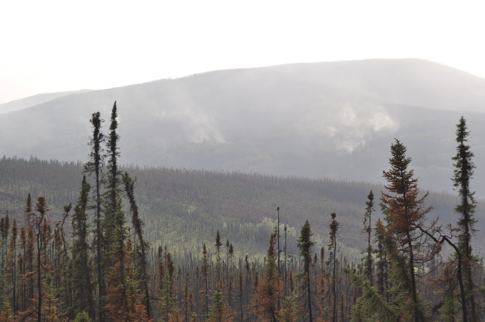
The countryside you pass through varies tremendously.  In many places its covered with Birch and Spruce trees like the land further south.  But, as you go north, you find increasingly large areas of no trees and meandering small lakes.  This is arctic tundra in the summer when the surface of the frozen ground has melted for a foot or so.  Underneath is permafrost on north facing slopes but is largely melted on south facing slopes. 
In Alaska they have a plant called Fireweed which grows in the short summer and blooms a pink flower.  We saw whole hillsides covered with it.  Beautiful. So the view out the window varies from tree lined road to wide open views that go for miles.  In the picture above, you can see the road going over a hill in the distance.
Fireweed on road bank.
 There was no rain which meant that there was no mud except where the highway department was spraying water on the road.  Those folks love mud.  Evidently in wet weather, the road can become treacherously slippery.  Potholes abound as does washboard.  I am glad we left the RV behind.  You also learn very quickly to slow way down and move over when vehicles come the other way.  Rocks go flying and your only hope of keeping your windshield is to be going very slow when they hit.


Gasoline at last!  Also lunch
Well, it turns out that The Yukon Crossing was open for business and thriving.  The crossing is a bridge over the Yukon River that also flows past Whitehorse, YT.  Boy had the river changed since then.  There were pictures in the Camp of trucks crossing on an ice bridge before the metal one was built,  THAT IS SCARY!
The most I have ever paid for gas, $5.50 a gallon and your choice was regular.  Glad to buy every gallon.   It turns out that the place is run by very friendly people and has good food.  It is also a bunkhouse for oil line workers.  We had salmon potato soup made with coconut milk.  Amazingly good.  The motorcycle guys show up just as we are leaving.  They had collected a fourth for their drive. They are really slowed down by the gravel patches and deep potholes.


Kentucky Motorcycists
So, we keep on driving.  Another several hours and 60 miles later, we reach the Arctic Circle.  A short time later, the Kentucky motorcycle guys pull in also.  One of them caught the mood very well.  He said "Take another picture of me, I drove 4000 miles to get it!"  There were several groups of people there and you rarely see grown adults having so much fun standing around a big sign. 


Add caption

So, a white van full of people pulls up, the people get out and mill around just like we did when we got there.  One guy comes running up with a rolled up rug.  What???  Oh there is no line for the Arctic Circle, so he unrolls the rug in front of the sign.  I got Pat up there for this photo.  It doesn't' get any better.  What does it look like around this part of the Arctic Circle, well here are a couple of pictures:
You can see the highway crossing the picture.
Woods and tundra in the region of the sign
 Not the mental image that I had.  We decided to drive on further to see what it looks like.  At this point we are only 1/3 of the way to the Arctic Ocean and it is 2:00 PM.  An incredible drive indeed.  We went another 16 miles into the Land of the Midnight Sun, hit a bunch of road construction and turned around.  We made it to Gobblers Knob and around OH Shit Corner, famous as a place to loose your load if you are not careful.  Not much changed as far as scenery.   Now for the long drive back.  by this time Pat's arm is tired of being in the truck (I think the rest of her was, too), and I was sick of being bounced around.  That little white Nissan does ride like a truck for sure.  Some time later, we reach Yukon Crossing again in time for dinner.  If its a guy place, the chili must be good, right....wrong.  And the Tums were at the RV.
If you look in the Milepost Alaska Travel book, you see all kinds of red warning text for the log of the Dalton Highway.  Well, it certainly has some amazing grades,   I saw a couple of 3 mile long 8% grades and  a couple of 1/2 mile long 11% grades.  Those end up being third gear (out of 6) trips at 25-30 mph.  So some of the road is paved, some is not.  Some of it is a 60 mph drive and some of it is a 15 mph drive.  In many cases the dirt road was better than the paved parts.

Above are a couple more pictures of the road.  The lower one is a hillside of Fireweed and the upper one shows how far that road goes.  You never think its going to end.  Those of you who know me also know that I have had a life long tendency to go down funky roads to see what's at the end.  Well, for the first time, I was beaten by the Dalton Highway.  We only went a third of the way.

Now for some useless information about the Arctic Circle.  It doesn't stay in one place on the Earth.  The Earth wobbles on its axis as it revolves around the sun, completing one wobble every 41,000 years.  That is known as the Milankovitch cycle after the Serbian climatologist Milutan Milankovitch.  (Yeah, sure, I knew him well.)  That translates to 200 miles of movement.  So in 40000years the arctic circle moves nearly to the Arctic Ocean and down as far as Fairbanks, AK.  However, I won't be around to see it, so a more meaningful measure is 25 feet per year.  Do you think they move the sign?


Sunday, July 12, 2015

There's GOLD in that thar gravel!

Originally we planned to stop in Denali National Park then go to Fairbanks.  The distances are not great but there is a lot of road construction that makes travel extremely slow.  As a result, we got to the Park about 5 in the evening on a rainy, muddy day to find the park jammed with people and no place for the RV.  There was a lot of haze in the air and the smell of old burned wood from the forest fires around here.  We had to go 65 miles north of the park to find a place to stay.  What a bummer.  You also couldn't see Mt. McKinley due to clouds.  We did get into a roadside RV park to spend the night and went on to Fairbanks the next morning.  We had managed a one night campsite stay in the Denali park campground for Sunday night, July 16th, but that was all they had.


Bob panning for gold in Felix Pedro Creek
When we got to Fairbanks, we were able to make reservations at an RV park 6 miles north of Denali for Monday and Tuesday night.  We also were able to get reservations on Tuesday for the shuttle ride through the park.  So with those plans made we set off to find out about Fairbanks.  What a crazy place.  It all started in 1902 when Felix Pedro discovered gold in a creek 16 miles North of where Fairbanks is today.  There is a roadside monument to him there and the site of his original discovery is open to public gold panning.  People are still mining gold in this valley.  Activities range from single miner operations to highly mechanized large mines that produce thousands of ounces of gold a year.  The city and surrounding area are littered with old gold mining equipment.

Forest Fires:

Two weeks ago it was very dry here and it still hasn't rained a lot.  In one night they had 130 fires started by lightning.  They were already fighting several fires that threatened towns.  They have gotten most of those under control but not before loosing the town of Willow, where the Iditarod starts each year.  The town is dedicated to sled racing and the dogs.  Many of the kennels were destroyed although I think the animals were saved.  It was on the news up here a lot and several operations are underway to help people rebuild.

When we went by here in the morning there was no fire.
Everything in the distance is burned
North and South of Fairbanks, there are still major fires burning.  You can see and smell smoke for probably 100 miles, no exaggeration.  So those of you who live in the West know about forest fires, but for those who have no experience, we took some pictures.  Brian and I walked into a fire in the Gila Wilderness once and neither of us will ever forget it.  In the picture below, the smoke is too thick to see anything clearly but everything from a short distance past the road to the top of that mountain you can barely see is burned and there are at least four major fires in this picture.  Here in Alaska, they let some of the fires burn in remote areas.  It has been found that the periodic fires keep dead wood quantities reduced which in turn reduces the intensity of the fires.  The fires themselves serve to rejuvenate the growth process especially in old forests that have begun to loose diversity.  However, the devastation is astounding for years as the regrowth begins and new trees establish themselves. On the Kenai peninsula and here, there are poignant signs along the highway saying thanks to the firefighters put up by the people whose homes have been saved.


Thursday, July 9, 2015

Kenai West

Back to the travelogue.  We left Seward and headed north again.  When we reached the turn off to Homer, we went in that direction.  Confused?  I think I am.  Anyway you come out of the mountains and cross the width of the peninsula on a pretty good highway.  The road runs along the Kenai River, the first of those I wanted to fish.  The Kenai runs from a huge lake in mountains to the Cook Inlet and serves as the main corridor for salmon returning to most of the upper peninsula to spawn.  Along the way, it is joined by the Russian River which originates in two smaller lakes in the mountains.  Literally millions of fish travel up this river.  Alaska game and fish has sonar stations set up on the river to watch the fish and they have tracked a million fish a day!  Fishing is extremely tightly regulated and they stop and start fishing depending on how many fish have successfully made it to their spawning grounds.  The Kenai is a large river whose mouth is an estuary with a great deal of salt marsh surrounding the water.  The Russian is more like a good sized Colorado river, such as the Frypan (Memories, Steve C!).  You can fish the confluence of the two rivers which is weird, if you are fishing the Russian, you use one type of tackle and if you fish the Kenai, you use different tackle.  The Kenai tackle is illegal on the Russian and they have signs marking the legal transition.  Fishing is also divided into whether you are fishing for Sockeye salmon, a fish like a large trout, or King Salmon which are as big as 50 pounds.  You have to have a stamp to catch Kings and must write down where and when you caught each one on the back of your license in ink immediately after you catch the fish.  You think there might be game wardens wandering around?  By the way, the summary book for the fishing regulations is 92 pages of 8-1/2X11 paper.

Anyway, we drove past all this to Soldotna, AK and stayed at an RV park at the edge of the town near the Kenai River.  This is the estuary area of the river.   It was now the Thursday before July 4th, so we expected crowds.  Not so much as it turns out.

I went fishing on the Russian, but had no luck.  I found one spot where people were catching fish all day, but it turns out that they were 3 generations of one family.  One guy reminded me of Joe Carr, he caught fish when no one else did. They were good fishermen.  I tried all the stuff I had bought and then tried the rig that we have used in Michigan.  No go.  Apparently there had been a small run of fish up the river very early in the morning and I talked to two fellows who had managed to get upstream fast enough to catch up with the fish.  They had caught fish.  Catching fish here is a matter of when the tides are and what day of the year it is.  They say that if the fish are running, it doesn't matter how you fish.  I would love to see that.

I went back to Soldotna and got Pat.  We decided to get her a license and try our hand at the morning tide the next day.  We spent some time exploring river access points on the Kenai and were going to start fishing at 4:30 the next morning.  We went to Ken's Bait and Tackle and got Pat's license.  Ken was in there and was very helpful in giving us an understanding of what controls fishing in Alaska.  He also said that they were only catching trout as catch and release on the Kenai.  He recommended two places on the Kasiloff River, south of Soldotna where people had seen sockeye and king salmon.  If you ever come here to fish, go talk to them in Ken's Bait and Tackle.  The Kasiloff was one of the rivers recommended by the Fish and Game officer who sold me my license.  So we went down there to try our hand.  No luck, no fish.  And that where the seagull got Pat.  That ended fishing because we spent the rest of the day in the emergency room. 

The next day we went down to the second spot on the Kasiloff.  Pat couldn't fish, but I looked around.  No action.  It was so slow that at one spot I saw a fisherman laying on his side hugging his fly rod fast asleep.  I wish I had had my camera.  That is one picture that the Alaska Tourism Bureau would never have the courage to publish.

We did, however, find out why we had seen so few moose elsewhere.  They were all in Soldotna.  It was a regular moose-in.   We saw a total of 8 meese (?, mooses ?, moose) in three days.  We got a reasonable picture of this gal, but in other cases, it was too dark or there was too much traffic to get pictures.  Pat saw a cow moose with two calves walking in a gravel pit beside the road, but there was no hope of getting a picture. Too bad. 

Moose a la Hinz
Then there was this one on the University of Alaska campus in Soldotna.  Sort of reminds me of John Hinz's moose.


The next day we had to go back to Anchorage so we could get to the orthopedic clinic to get Pat's arm put in a cast.  As a result, we got to Anchorage on 4th of July evening.  It turns out that the pastor of the Anchorage Baptist Temple went to school with Judy.  Pat and her sisters knew them until they left Tennessee to come to Alaska.  We decided to go to church there on Sunday and heard a great sermon and enjoyed visiting with the Prevos.  We enjoyed it so much that we went back for Sunday evening service. 

Monday, was orange casting day.  Tuesday we headed out of Anchorage to Palmer on the way to Denali and Fairbanks.

FLASH! PAT AND BOB ARE AT THE NORTH POLE!!!

You can't get better proof than this!
Well, its really important.  When you get to visit Santa Clause, can you not be excited?  We really went to the North Pole today.  Here's proof for the skeptics in the crowd!


Wonder how big the reindeer are
Santa was here, too.  Bigger than life. 


He has a really neat workshop.
 Here is his workshop.  Notice there is no snow, well it could be global warming or it could be that its July.  But, it is Christmas in July here!


Santa felt sorry for Pat and signed her cast.
Not only did we get to visit, we got to talk to Santa.  All you grandkids had better be good. You're on the hook  now.  We told Santa how good you are.

Santa thought that it was terrible that a seagull caused Pat to break her wrist, so he signed her cast.  One of his elves did also.
The real deal, Santa and his elf!

Wednesday, July 8, 2015

So, back to the travelogue

Events sort of superseded the travelogue.  It seemed important to let everyone know about Pat, especially that she is OK and doing just fine.  The latest update on that story is that Monday we went to an orthopedic clinic.  They confirmed that the injury to her wrist did not need surgery and put a cast on her arm.  Originally we were told that the cast would have to go from her shoulder to her hand, e.g. her entire arm.  The orthopedic surgeon decided that such an extensive cast was unnecessary so her cast goes from her palm, around her thumb, and only halfway up her lower arm.  She has her elbow free to move which is a great thing.


Alyeska Ski Resort main run..STEEP
Our lodge (RV) and their lodge
When last heard from, the Carpenters were in Anchorage and heading for the Kenai peninsula.  We drove south from Anchorage along what is known as the Turnagain Arm.  It is a 60 mile long arm of water off of the Cook Inlet that is bounded by mountains.  As you would expect, a beautiful drive.  We stopped in a small town, Girdwood, that has a beautiful ski run (Alyeska Ski Resort) at its edge.  They were mountain biking which meant that a lift was running and the place was open for business.  So I went to the ski patrol hut where a ski patrol member is always welcome and had a nice visit with the people on duty there.  They gave me info on the area and on the operation of their ski run.  It's 3/4 double black diamond trails, wow...Phil and Marty would go nuts!  Weather permitting, they ski off of the snow covered ridge at the back of the first picture.
Girdwood is also the home of the Crow Creek Mine, a highly productive gold mine for many years. Today its a museum where you can go to the river and pan for gold.  I will do that later on the way back from further south. We drove up there and talked to the people running it and got the skinny on how they operate.


Resurrection Bay at Seward
Continuing south on the Seward highway, you round the end of Turnagain Arm and climb over Moose Pass.  After you cross the summit, there are three rivers where there are public gold panning areas.  Again on the way back when I am unhooked from the RV...get rich quick!  A little later the highway divides, the east side going to Seward and the west branch going to Homer.  We started with going to Seward.  What we found was that the Southeastern side of the Kenai peninsula is very mountainous and sparsely populated while the Southwestern side is much less mountainous and much more heavily populated.  Naturally, the drive to Seward consisted of your standard beautiful snow covered peaks, mountain streams and fine lakes. 

Seward campground full of rv's
Seward is a small town that is a fishing port, a port for cruise ships and the south end of the Alaska Railroad (the ONLY railroad) that travels up through Anchorage, Denali NP, and ends in Fairbanks.  If you ever take one of those land and sea cruises that the cruise lines sell, you will come here either to go to Denali or to join your cruise ship after being in Denali.   So the town has a good industrial base and prospers.  It sits at the top of Ressurection Bay.  Well, when we get there its three days before the 4th of July and the joint is jammed.  Come to find out that they have a widely attended mountain marathon race that brings people from all over the world to run.  According to the Anchorage newspaper this years winner was from Australia and he set a new record..it was referred to as being won by an "outsider".  We did manage to get a parking space on the waterfront municipal rv park.   We enjoyed wandering around the town, having a drink of the local beer and a pretzel.


Giant, road-eating waterfall
We discovered that the ladies running the cash register at the hardware store were the resident experts at where the fish were biting and what was catching them.  Armed with their best advice and several dollars worth of the best, hottest lures, we went fishing.  This meant a drive south of Seward down a dirt road to Lowell Point.  So, you turn the first corner and find a waterfall about to swallow you and the road.  The buildings on the left in the picture are one of the canneries in town.  When you finally get through the potholes and sort yourself out, you find a really peaceful state park to fish at.  The beach is gravel rather than sand and is stuff ground up by the glaciers.


Resurrection Bay at Lowell Point
Pat tried, no fish
So afishing we went,  tried all the tackle that they recommended.  Fished shallow, fished deep fished close, fished far.  You guessed it, no fish.  Oh well, we had a really nice day.  We left and went over to the other side of the bay to a ship dock.  We found people over there fishing who said that they had some luck about 10:30 the night before until four seals showed up and cleaned out the fish.  Now that's a new excuse to a guy from Ohio. 


Bo tried, no fish
 

 Remember those cruise ships.  This is a Royal Norwegian ship leaving harbor about 10:00 at night.  They are huge and absolutely silent.  They could go right by the rv and you would never know it.  I wanted this picture two days before when a Holland America ship was in port but it went completely by without us knowing it.  For this one, I waited by the shore until it started moving and then went to take the picture.


After a few days, we left Seward for the Homer area.  I wanted to fish three rivers on the western side of the Kenai peninsula that are famous salmon waters.  On the way out of town, we detoured to see the Exit Glacier, which got its name from the first explorers to go through the ice field that covers the top of many of the mountains here.  The ice field is 50 miles long and 40 miles wide.  When the people came to this glacier it made a good exit from the ice, so it was named exit glacier.